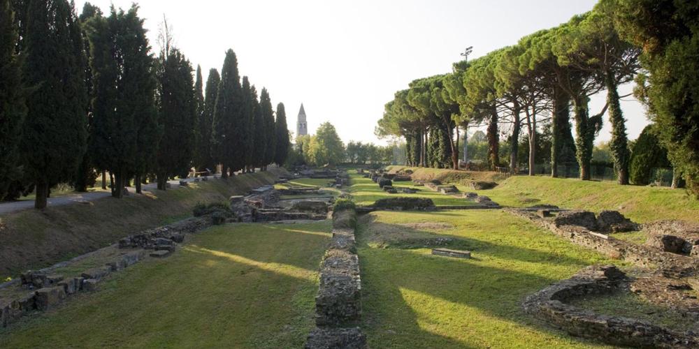
River Port

The Greek Geographer Strabo reports about Aquileia: “There is an inland voyage thither for merchant-vessels, by way of the River Natiso, for a distance of more than sixty stadia. Aquileia has been given over as an emporium for those tribes of the Illyrians that live near the Ister; the latter load on wagons and carry inland the products of the sea, and wine stored in wooden jars, and also olive-oil, whereas the former get in exchange slaves, cattle, and hides”.
You can visit the remains of the river port—among the best preserved port installations in the whole Roman world—by walking on the so-called “Sacred Way”, a suggestive tree-lined pedestrian lane built in 1934 with the aim of connecting the Roman vestiges, the First World War cemetery and the basilica with its extraordinary Early Christian mosaics.

As you walk, you'll see the quays, i.e. the vertical slabs used to load and unload the goods. Some of them still bearing signs of the games played by sailors and dockers during their free time.
Above the quays you'll see the remains of the city walls from the Late Antiquity (4th century) and of a later defensive enclosure (probably from the 5th century) built to strengthen the former and much closer to where the river bed was found.
You'll also see the remains of the walls of the warehouses used to store the trade goods, which probably included rooms used as offices. Built in the early 1st century, these buildings were over three hundred metres long, but only up to thirteen metres wide.
Look for the special stones used to moor the boats: some of which have a horizontal hole; others are shaped as protruding parallelepipeds with a rounded edge and a vertical hole. The latter stones may have served as supports to accommodate wooden cranes used to help dockers load and unload the goods.
River Port
Until March 31st: from 9:00 to 16:00
From April 1st to end of May: from 8:00 to 19:00
From June to August: from 8:00 to 20:00
In September: from 8:00 to 19:00
In October: from 8:30 to 18:00
Free entrance.

