Wider Kazakhstan Settlements - Silk Roads: The Routes Network of Chang’an Tianshan Corridor

The paths of the Silk Road stretch across continents like a web, the various routes connecting to others in every direction. Although goods and ideas were exchanged along the entire network, each section had its own unique characteristics.
One of the most important parts of the Silk Road was the 5000-kilometre-long Chang’an-Tianshan Corridor. Beginning in Chang’an, the central capital of China during the Han and Tang dynasties, the corridor continued through Central Asia, eventually ending in the Zhetysu Region in modern-day Kazakhstan, corresponding with the location of Almaty. These two centres operated as driving forces behind Silk Roads trade, maintaining an influential role in the trade history of Afroeurasia at large.
The World Heritage Property covering the Chang’an-Tianshan Corridor is composed of 33 different components in China, Kyrgyzstan, and Kazakhstan, connecting ancient societies that grew into some of the world's greatest cities. Eight of these components are in Kazakhstan and have been chosen because of how well they represent the region and the era, and we can group three of them together as a cluster to visit - Talgar, Kayalyk, and Karamergen.
The medieval towns of Talgar, Kayalyk, and Karamergen had many similarities to other trading settlements along the Silk Road - but these southern Kazakhstan sites are unique to the Chang’an-Tianshan Corridor. Found in the countryside where the steppe meets the mountains, the settlements provided agriculture oases, flush with crops and livestock. With their distinctive geography, advanced city infrastructure, Turkic foundations, and cosmopolitan history, these cities played an important role in the region during the Middle Ages. The once bustling towns are now archaeological sites that reveal findings from the lives of people who lived in these medieval settlements.
History & today
During the latter half of the 6th century these three sites in the Zhetysu region became part of the Turkic Khanate. The nomadic empire was far reaching, dominating thousands of miles of Central-Asia. It was during this time that settlements like Talgar, Kayalyk and Karamergen began to see urban development. Key similarities between these sites included a rectangular settlement shape that was enclosed by a wall and surrounded by several watch towers. Benefiting from the nearby rivers, this region flourished in agriculture production, creating innovative farming techniques. The downward turn of these settlements came during the later end of the 13th century.
Talgar
It is believed that the medieval settlement of Talgar was established as early as the 8th century. In the 9th century, a Turkic tribe lived along the Silk Road on Talgar’s land. Over time, Talgar developed into a popular town, catching the attention of travelling merchants and artisans. By the 10th century, Talgar was quickly populating, and its significance and economic success soared under the Turkic Karakhanid dynasty administration. Imports from India, Iran, China, and Japan were discovered in the medieval Talgar settlement through archaeological excavations. The site also showed signs of urban development, old city towers and defensive ramparts, water supply systems, cobbled roads, trade markets, and a large courtyard on the site premises.
Talgar was rediscovered by archaeologists in the 19th century. Around the same time that it piqued their interest, it was a stanitsa - a village with a Cossack leader. With the help of a small group of archaeologists, initial surveys of the land were completed. A rectangular portion of the original city of Talgar has been excavated. Findings show that Talgar was religiously pluralistic, with fragments of artifacts belonging to Christianity, Manichaeism, Islam, and Buddhism discovered in the ruins. Findings also reveal transitions away from nomadism and the formation of an urban culture. Today, tourists can still see the city walls that surrounded the original medieval Talgar settlement. They can also visit the modern town Talgar, which is home to about 45,000 residents. Both the medieval excavation site and the modern town are at the foothills of the Talgar Mountains in the southern Almaty province of Kazakhstan.
Kayalyk (Antonovka or Koylyk)
Kayalyk was once the largest centre of the Lepsy Valley. Strategically built on the Ashybulak Stream (Ashchi-Bulak), the area had fresh water for fishing and drinking water was readily available for travellers. Kayalyk is famed for being the capital of Karluk’s 'dzhabgu'. Located in the northeastern area of the Ili Delta, it spread from the Antonovsk settlement along the Karatal River Valley. Kayalyk was protected by a fortified wall reaching up to maybe six to seven metres. However, the height is only four metres tall as there are only some parts which still stand today.
Kajalyk was written about in extent during its prime, journal entries reflect on the settlement as an important trading centre. Most notably written about by William of Rubruck (Willem van Ruysbroeck), an ambassador of Louis IX the King of France. Rubruck passed through on his way to visit Mongke Khan, the fourth Khagan-Emperor of the Mongol Empire. Rubruck wrote about the Christian settlement that he found near Kayalyk. At this time, Christianity was in its early days, making the Christian churches a unique site for many during their travels. From Kayalyk he continued on through the Tentek valley as he made his way into China.
Often recognized as a hub for culture and handicrafts, Kayalyk grew to be the largest trading centre from the 8th century. During its prime, the settlement was famous for its bazaars. It was the best place for trade north-east of Semirechye, a province of the Russian Empire. In 1964 archaeologists began excavating the site. Among their discoveries was confirmation of the area's religious tolerance. Modern day discoveries of the site include a mosque, a Buddhist temple and two mausoleums. Proving that Kayalyk welcomes travellers from many religions in Central Asia. From the 12th to the 14th centuries, religion flowed through this community. Today, the historic site sits just outside of Koylyk village and is 190 kilometres from Taldykurgan.
Karamergen
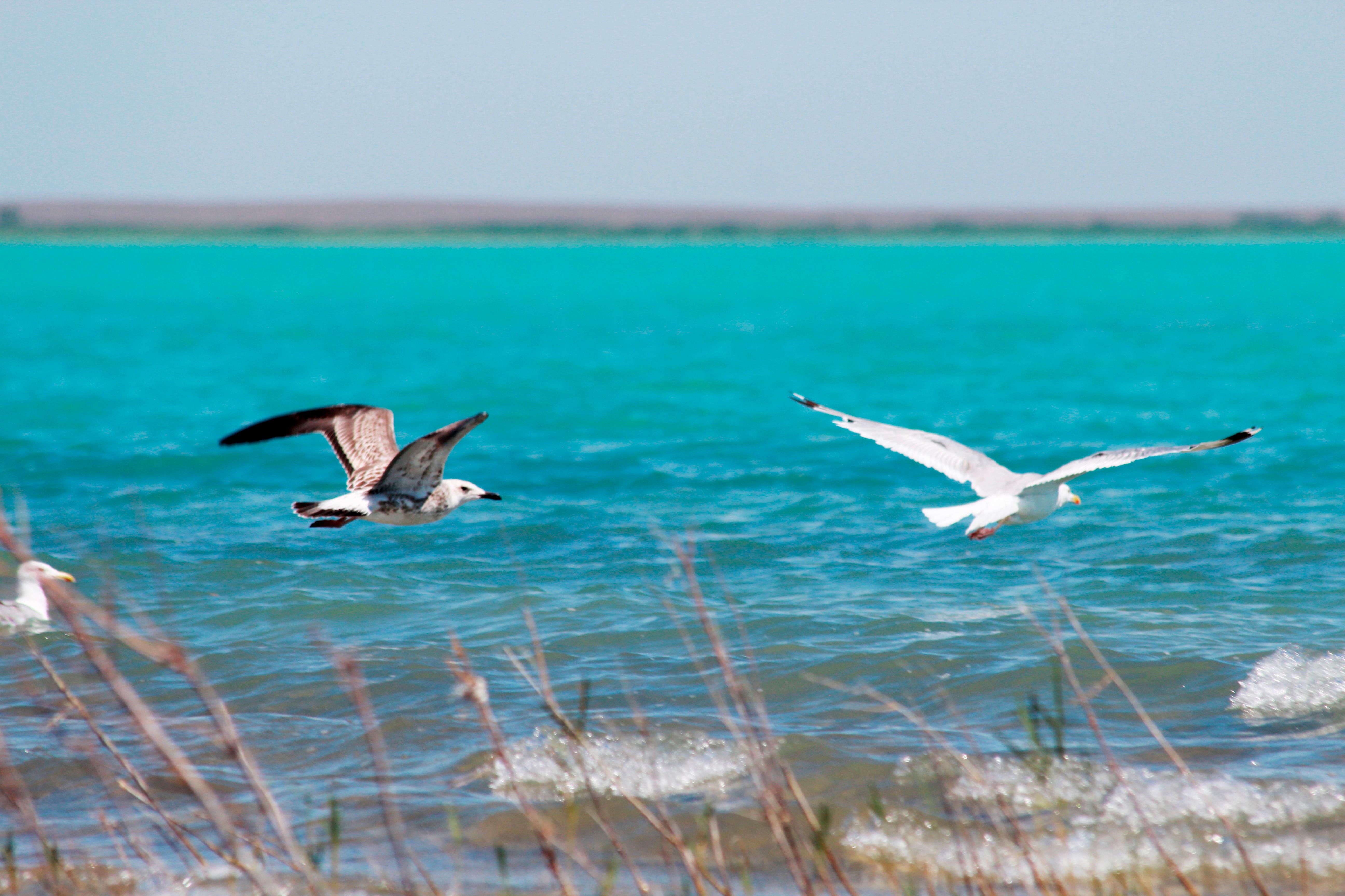
From the 12th to the 13th centuries, Karamergen was known as the largest medieval agricultural settlement in the Ili delta. Located in the Sary-Esik desert south of Lake Balkhash, Karamergen was strategically located in the channel between the Ortasu River and Mingilichi. With a large amount of water flowing from Lake Balkhash, the settlement flourished in the irrigated delta of the river. The village is translated as 'black hunter', correctly chosen because of the easily accessible areas for hunting in the Tyymgay forests and fishing on Lake Balkhash and its tributaries.
The fall of Karamergen happened in the 13th century when Mongol nomads invaded. Unfortunately for the residents, this happened during the hot and dry season when erosion disrupted the flow of the river. Due to the lower water levels, the settlement lacked the water features that made the area so special. With a frustrated, weak community, Karamergen was unable to fight off the Mongol nomads. War, civil unrest, and unpredictable desert weather drove the settlers out of Karamergen and ended the dominance of the agricultural settlement. Remains of adobe buildings destroyed by the Mongolian nomads, a dried-up river valley and the shadow of an ancient caravan town remain.
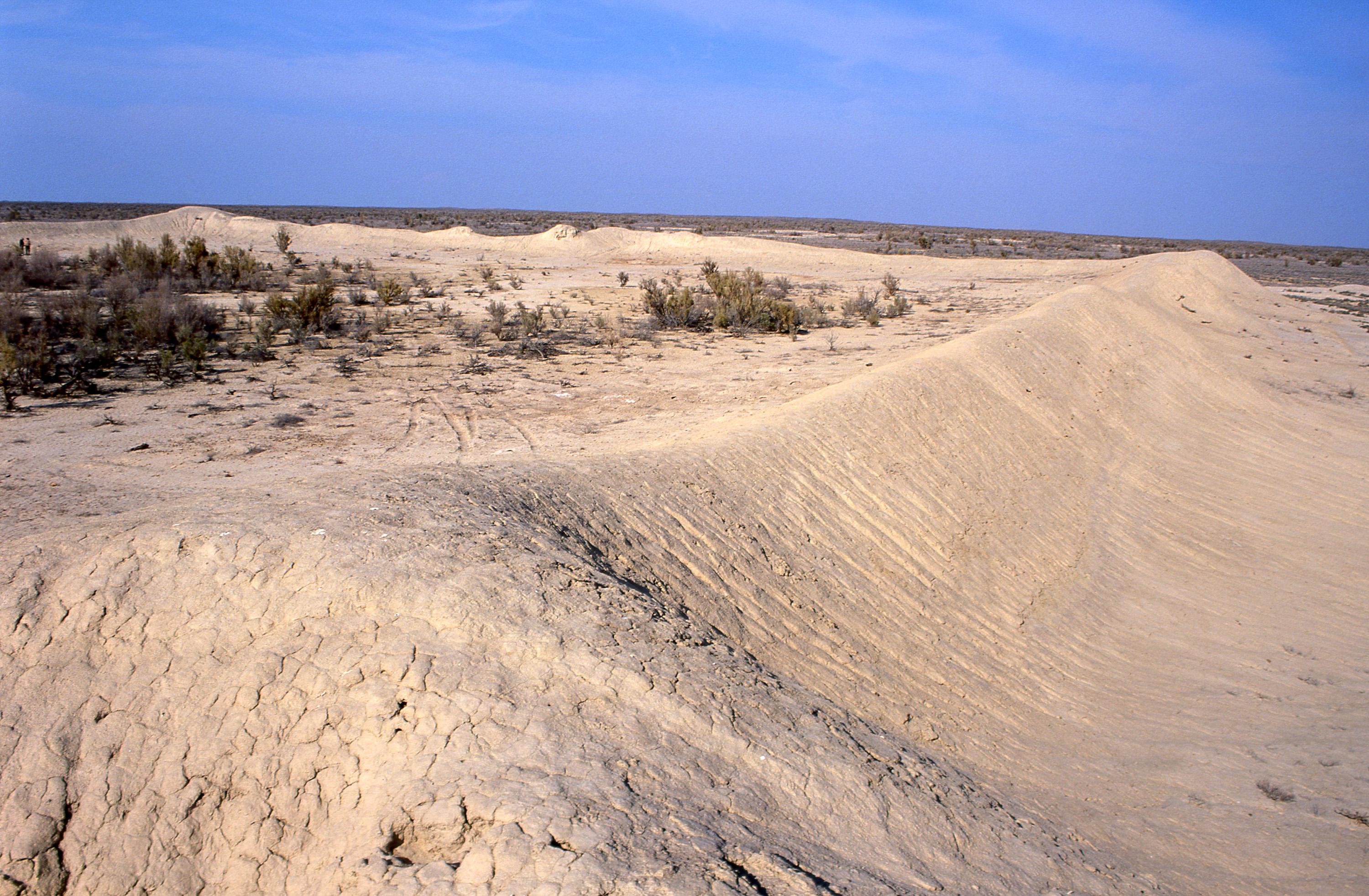
Today Karamergen is located in the Balkhash district of the Almaty region, about 170 kilometres from the village of Bakanas. The flowing rivers that fed the early settlement have now dried up and depleted all resources. This place, separated from modern civilization, is used for research and tourism. On the territory, visitors can see the remains of buildings, irrigation systems and old agricultural fields of the ancient settlement. See the ruins of a 5-metre straw-brick wall and several building foundations that outline the once prosperous city.
For visitors, Talgar, Kayalyk, and Karamergen offer not just historic remains of the Silk Road era, but also breathtaking scenery and access to modern civilisation. Spread out over hundreds of kilometres, these three sites offer a well rounded representation of the Chang’an-Tianshan Corridor. Explore the ruins of the medieval trading settlements and then head into the nearest town to dive into Kazakh cuisine and culture. Offering beautiful churches and public buildings, the neighbouring towns connect past and present day Kazakhstan. Nearby are also cultivated freshwater ponds and lakes with fish for sightseeing. With idyllic steppes meeting snow-capped mountain peaks nearby, it's easy to imagine the landscapes the caravans would've travelled through centuries ago.
How to get there
For the best travel experience, fly into Almaty International Airport. There are several smaller airports in the surrounding area like Boraldai Airport that will work as well. Almaty offers a central starting point that will act as a home base for your travels.
With Talgar only 45 minutes from the two airports, it is the best site to start or end your trip. To access Kayalyk, drive 450 kilometres north east from Almaty for five hours. Karamergen is located 400 km from Almaty and about 7 hours' drive north through the regional centre Bakanas on a sealed road, then along a dirt road through the village Bereke along the ancient dry bed of the Otrasu river. Karamergen and Kayalyk are not connected by a direct route, so travellers return to Almaty to get to both sites.
When to visit
The medieval excavation sites of the Chang’an-TianShan Corridor are open all year. However, the climate in southern Kazakhstan is generally cold, and precipitation is at its heaviest during the winter season. Summers are generally mild, and they provide ideal conditions for hiking in the neighbouring mountains. However, these mountains are extensive in length and not intended for beginners.
How to visit
Visiting Talgar, Kayalyk, and Karamergen will take visitors anywhere from three days to several weeks due to their distance from one another. It is possible to combine a visit to Talgar and Kayalyk with a visit to museums, resorts, and monuments of the surroundings. The visit to the monument itself can take from 1 to 3 hours with a specialist or a licensed guide. Trip itineraries can be shortened or lengthened to prioritise specific attractions and experiences.
Each site can take anywhere from a few hours to several days to visit. For example, some hiking tour packages for Talgar can last as long as a week, but one can find plenty of enjoyment from one day at the excavation site and its neighbouring town. There are few means to get around these sites without the help of air travel and taxis, although guided tours through Kazakhstan provide tourists options to stop by the excavation site. When the weather conditions are appropriate, visitors have the opportunity to participate in skiing tours through the mountains.
